Posts

Showing posts from 2007

Photos from Newdegate Pass Mt Field

Click to view some photos taken at Newdegate Pass in December

Volunteer Work

Friends of Mt Field Track maintenance Tarn Shelf at Mt Field NP on Saturday 8 Dec 07 Some 280 metres of track was worked on, with several sections being hardened with rock and duplicated tracks closed off. Marker posts were used to make the track location clearer and to indicate closed sections. Hessian that was already stockpiled on site was laid on eroded and boggy sections. Sections closed off from the previous working bee on 6 May were visually checked and it would appear that walkers are avoiding using these old tracks. Photopoints were established at various spots and photos taken to enable a comparison to be made at future dates. If you are interested in helping or for more information click here

An Attempt on Mt Jukes

Wednesday 14 November 2007 We located an old bulldozer track uphill from the lookout and eventually came onto a cut track with plastic markers and occasional wooden posts. The track contoured the slope crossing small gullies, but at 828309 it ceased and we could not locate an extension anywhere. We both wondered why the cut track should be heading in the direction it did as we thought it more logical to ascend more directly to Proprietary Peak. Although conditional were quite cloudy when we started by the time we reached the end of the cut track it was quite drizzly and visibility poor with the peaks now completely blanketed, so we decided it best to retreat and return when conditions were better

Hard Time in the Bush

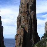
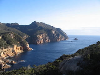
After I could finally think beyond the immediate urgency of my horrible accident, it was to wonder how I could have possibly coped without Alan and Nigel. They stopped the blood flow, cleaned and patched me, set up the tent, put me in it, and brought food when I had recovered sufficiently to drink and eat. Earlier that day we had walked past profusely flowering bushes, where the big fire had gone through a couple of years ago. By the time we left Lunchtime Creek showers had developed but the bush held back the wind until we came to the notoriously exposed area above Perdition Ponds. In the buffeting here I had trouble making forward progress and whilst trying to get my feet onto an even surface a particularly strong gust hit. I felt myself losing balance and was literally blown into a dive onto rocks. I realised what was happening but was unable to prevent it. The instance before impact I probably yelled in horror because my tooth got chipped without damage to the mouth. Blood wa

Flat Rock from Chauncy Vale

Flat Rock walk Wednesday 10 October 07 Dave was sick and he looked as bad as he sounded too, so Nigel and I went searching for Flat rock and Alpha Pinnacle via map and GPS. We went via Guvys Lagoon to Devils Elbow and then followed old logging tracks onto Flat Rock where there was lots of Tetratheca in flower and soon this will be joined by the plentiful bushes of Golden Rosemary. The forest in this area was very nice despite being once logged and there were lots of snig tracks, but recovery has been good and in time will not be very visible. Old stumps were noticeable but not enough to spoil the scene, expect in a few spots where more recent woodhooking had taken place. We were aware that there was insufficient time to get to Alpha Pinnacle Reserve, but after getting through the maze of old tracks we found ourselves at the foot of a very old and overgrown track leading up the valley to the reserve. However our belief now is that the best approach would be to stay higher an

Letter Published in Mercury Sat 6 October 2007

Image
Massive Clearfell at doorstep of Three Capes Eco-tourist venture Over a period of more than 30 years I have regularly walked to the spectacular Cape Pillar in what is now Tasman National Park, but not so long ago the start of the track was altered. It is now so very sad to see the terrible wound that has been inflicted on the original track, in the form of massive clearfelling of the forest. Clearly the forest industry has no heart and soul. It seems ironic that Lennon and Wriedt have been in the area espousing the marvels of the place and how they intend to invest an estimated $15 million to create a Three Capes walk to attract eco-tourists. While all this has been going on, the Government has been responsible for the wholesale destruction of the land bordering the proposal. Why is it that politicians can not see that this is equivalent to shooting yourself in the foot? The mass destruction of forests is not something that rates highly as an attraction to tourists. Forestry sign

Tasman National Park

Image
Tasman Coastal Track and Cape Hauy Wednesday 26 to Friday 28 September 07 This was two walks spread over three days. The first two on the Tasman Coastal Track commencing from Fortescue Bay on an overcast but mostly fine day with a camp just before Tatnells Hill. There was a decent sort of breeze in the bay but this became quite strong once we reached Dolomieu Point with the wind howling and the seas pounding the cliffs. However even though only a metre or so in from the cliffs at times the wind just shot straight up leaving us in relatively calm conditions. We reached the campsite close to 5 pm and Sue headed off to find the creek for water whilst I put up the tent. After going a fair distance Sue became concerned that she hadn't arrived at the creek and decided the best option would be blow her whistle to make sure she hadn't wandered in the wrong direction. The sign did indicate a 10 minute walk to water and this did prove pretty right, but the track is now a bit over

Tasman Slideshow

The photos can be viewed as a slideshow --------------

Freycinet Peninsula

Image
Gates Bluff Wednesday 5 September to Friday 7 September 07 The route for this walk was modified after looking at a map marked with the way Andreas Hack planned to walk through the bush near the Hazards Lagoon. We adopted a variation on this by leaving the Isthmus Track about 400 metres from Wineglass Bay and after a short bit of bush came out at the side of Hazards Lagoon, which was mostly dry at this point. The conditions were so good and pleasant that we walked along the sandy shore line eventually coming to a section filled with plenty of water, crossed a small bush patch to reach a very pleasant small lagoon. Beyond this an attempt to make a direct line for Lagunta Creek was quickly reversed and we cut across to the beach a bit over 100 metres north of the creek outlet. The flowers from here through to Cooks were splendid, especially the Thryptomene. Unfortunately the dunes of Cooks Beach are being undermined by the sea. We left the track just north of

Bluff River Gorge

Wednesday 29 August Noted that the vehicle track in has been blocked by a trench. We took the second vehicle track as usual but this time decided to head directly to the gorge at the end of it; however it turned out to be just a subsidiary creek that actually joined the Bluff River north of the walk crossing point. When we did find the walking track we crossed over the river, followed that side of the gorge down and returned via the big overhangs before exiting and returning to the car.

Latest News

Evan has his PhD presentation ceremony in mid July and we are heading off to Canberra. This time, we plan to head north to southern Queensland and northern NSW after leaving Canberra. Our furthest destination is Carnarvon Gorge, which has quite a few walks with the sandstone gorge and on the surrounding high areas. The route north will be through central NSW and for the return we plan to come down the coast way into Victoria.
Image
Gumtop Ridge Under Snow Walked along Ringwood Trail on Gumtop Ridge and removed t he Elishas Tears growing in a small wet area below Mt Marian. Quite heavy snow had fallen overnight so conditions were not ideal for the job, but it was beautif ul and fascinating to be there. Although only one plant was thought to remain at the site, we did find several and had to clear snow away in order to get at the multi-trunk bushes. If you want to see what it was like up there check out the photos are at http://home.iprimus.com.au/pjfranklin/marian

Walk

Walk to Mt.Direction Sunday 3 June 07 Cloudy but mostly fine, with just a touch of very light drizzle for a couple of brief moments. Arrived at Risdon Brook Dam to find a big group of Pandani walkers and another of HWC all going to Grasstree Hill, so changed our walk from there to Direction. On walking over the plateau below Mt Direction we noticed another big group of walkers, that we later discovered were the Eastern Shore Ramblers. Between them they had about 50 people. Party Alan & Sandra Cross Peter & Sue

Photos Cathedral Mt Tas

Click the link here to see Flickr: Photos from PeterJF