Posts

Tasman National Park
Image
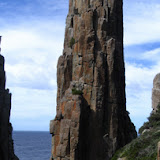
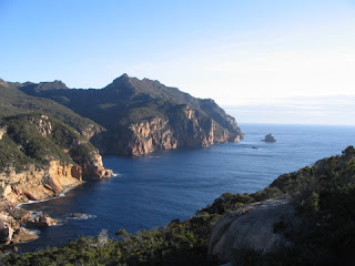
Tasman Coastal Track and Cape Hauy Wednesday 26 to Friday 28 September 07 This was two walks spread over three days. The first two on the Tasman Coastal Track commencing from Fortescue Bay on an overcast but mostly fine day with a camp just before Tatnells Hill. There was a decent sort of breeze in the bay but this became quite strong once we reached Dolomieu Point with the wind howling and the seas pounding the cliffs. However even though only a metre or so in from the cliffs at times the wind just shot straight up leaving us in relatively calm conditions. We reached the campsite close to 5 pm and Sue headed off to find the creek for water whilst I put up the tent. After going a fair distance Sue became concerned that she hadn't arrived at the creek and decided the best option would be blow her whistle to make sure she hadn't wandered in the wrong direction. The sign did indicate a 10 minute walk to water and this did prove pretty right, but the track is now a bit over...
Tasman Slideshow

The photos can be viewed as a slideshow --------------

Freycinet Peninsula

Image
Gates Bluff Wednesday 5 September to Friday 7 September 07 The route for this walk was modified after looking at a map marked with the way Andreas Hack planned to walk through the bush near the Hazards Lagoon. We adopted a variation on this by leaving the Isthmus Track about 400 metres from Wineglass Bay and after a short bit of bush came out at the side of Hazards Lagoon, which was mostly dry at this point. The conditions were so good and pleasant that we walked along the sandy shore line eventually coming to a section filled with plenty of water, crossed a small bush patch to reach a very pleasant small lagoon. Beyond this an attempt to make a direct line for Lagunta Creek was quickly reversed and we cut across to the beach a bit over 100 metres north of the creek outlet. The flowers from here through to Cooks were splendid, especially the Thryptomene. Unfortunately the dunes of Cooks Beach are being undermined by the sea. We left the track just north of ...

Bluff River Gorge

Wednesday 29 August Noted that the vehicle track in has been blocked by a trench. We took the second vehicle track as usual but this time decided to head directly to the gorge at the end of it; however it turned out to be just a subsidiary creek that actually joined the Bluff River north of the walk crossing point. When we did find the walking track we crossed over the river, followed that side of the gorge down and returned via the big overhangs before exiting and returning to the car.

Latest News

Evan has his PhD presentation ceremony in mid July and we are heading off to Canberra. This time, we plan to head north to southern Queensland and northern NSW after leaving Canberra. Our furthest destination is Carnarvon Gorge, which has quite a few walks with the sandstone gorge and on the surrounding high areas. The route north will be through central NSW and for the return we plan to come down the coast way into Victoria.
Image
Gumtop Ridge Under Snow Walked along Ringwood Trail on Gumtop Ridge and removed t he Elishas Tears growing in a small wet area below Mt Marian. Quite heavy snow had fallen overnight so conditions were not ideal for the job, but it was beautif ul and fascinating to be there. Although only one plant was thought to remain at the site, we did find several and had to clear snow away in order to get at the multi-trunk bushes. If you want to see what it was like up there check out the photos are at http://home.iprimus.com.au/pjfranklin/marian

Walk

Walk to Mt.Direction Sunday 3 June 07 Cloudy but mostly fine, with just a touch of very light drizzle for a couple of brief moments. Arrived at Risdon Brook Dam to find a big group of Pandani walkers and another of HWC all going to Grasstree Hill, so changed our walk from there to Direction. On walking over the plateau below Mt Direction we noticed another big group of walkers, that we later discovered were the Eastern Shore Ramblers. Between them they had about 50 people. Party Alan & Sandra Cross Peter & Sue

Photos Cathedral Mt Tas

Click the link here to see Flickr: Photos from PeterJF

The garden dispute

Image
The bare spot is where a previously overhanging bush was removed and the leaves have not yet come back. Eva was going to cut everything back from the footpath to behind the bare parts. The untidy spot is where parts of a creeping bush has spread over another and she wanted to remove it. It looks fine to us as it is. You will note the little wall which is pretty well on the boundary. The story Let me share a recent episode with you about our neighbour at number 8, by the name of Eva. You see I find it so incredible that I have to tell someone. Now I acknowledge that our native garden would not appeal to many people and it doesn’t have that precise controlled look adored by many. However I still got quite a surprise when Eva told me what she was planning to do with our garden. You see there is a bare patch of little branches and a few unruly bits and pieces that she doesn’t like and you know they would be a fire hazard. So the answer is cut them back and make them look ...

Bluff River Gorge

It was a fine day on 3 November , but it seems that my memory is not up to scratch, as even though it was only 3 years ago that I did this walk I mistakenly felt that the river crossing point was where the track first came down to the river bank. At this point the track continued uphill and seemed to be heading out of the gorge entirely, so I assumed that this was an optional exit point. This was not so because although the track went out of the gorge it then lead back to meet up with crossing point. Anyway the walk was most pleasant, although quite a warm day, and the flowers were at their peak. Click to view photos of the walk Here is a brief description of the route The track starts off after a short sandy descent off the main vehicle track to pick up the walking track. It follows along the gorge gradually dropping close to the river bank, but then climbs back uphill and actually passes back above the gorge rim before leading on to a wide shelf and from here the track drops down ...