Posts

Showing posts with the label Bushwalk

Sarahs Waterfall

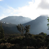
Thursday 7 August 2014 The final plateau leading to the waterfall was very pleasant open eucalypt with spacious low grassland.  The big v shaped valley below the falls was scenic as was the view of Table Mountain, which seemed quite close beyond the trees.   At the start of the walk the breeze was quite chilly but once we had a bit of tree and hill protection conditions became most pleasant, especially when in the sun. The falls had a reasonable sloping drop of 40 metres and a good flow of water was going over.  The views were particularly good from the sheltered western side which had a number of edges in convenient viewing locations. The walk started on a logging road then an old vehicle track and eventually through a section of fairly untouched open woodland.  It took almost 1:15 to get there and much the same to return. Although the return distance was 9k the wandering about the falls area added well over another kilometre.

Recent Walk and Photo Album

Image
Sue and I have been on a couple of three day bushwalks over the last month. One was to Mount Rogoona and a few people noticed the blog post for that walk. I did introduce it with the words “a bushwalk where I fell into a creek, missed the intended track and took a photo of a snake without realising it was there”. I did refer to a photo album and several comments received back were along the lines of where was the snake photo, so it is below.  

Bushwalk to Walled and Gould

Image
---- October 2011 Album of photos Click image to go to album Walled Gould

Budawangs Photo Album

Image
Click the image below to view photos from a walk in the Budawangs, Morton national Park NSW.   The walk was  the Foster, Styles Creek, Hidden Valley, Quiltys Circuit   from 20-23 September 2011   Budawangs2011

Pelion Circuit

Image
In mid October i managed to get a 4 day spell of fine weather to do the Pelion Circuit. A photo album is on the web. Click the image below to view Pelion Circuit

Latest Bushwalk

Image
13-16 April 2010 Our latest bushwalk was to Artillery Knob and  a report and photos is at the link attached to image below.  

Recent Bushwalking Videos Added

It is very easy to create videos from Picasa and the software then uploads to the web, so it just a matter of selecting, in this case, the slides and some music and clicking a button Video of South Cape Rivulet Western Arthur Range

Western Arthur Range Potential Congestion

I recently went on a bushwalk through the Western Arthur Range where we met a commercial party from Tasmanian Expeditions at Lake Oberon. They were camped at lake Oberon and staying there for 3 nights and group of 4 (2 clients and 2 guides) were spread out on 3 of the 4 available platforms.  The leader did offer to consolidate to two platforms to allow our party of 4 room, but as no one else arrived that day we did not need the space and manage to fit on the hardened area need the lake shore.  However in differing circumstances it could easily get overcrowded there with the limited camping available. I probably would not have thought much more about this, but have just received an newsletter (don’t know how I got on the mailing list) from Tas Expeditions, in which they promote future Western Arthur walks.  These are described as 13 days with 12 nights which includes side trips for “6 trekkers” plus I assume 2 guides and departures  in 2010 for 10 January, 7 Feb and...

Bushwalk to Prosser Sugarloaf

Saturday 26 July 08 We made a mistake in picking the track and missed out on getting to Prosser Sugarloaf. For details and photos

Plunkett Lime Bay Bushwalk

The whole day was delightfully fine and calm, with initial patches of morning fog about. See http://bushwalks.blogspot.com/ for more

Bushwalk to Tyndall Range

Wednesday 23 April 08 to Friday 25 April 08 The Tyndall Range is of conglomerate and is around 1000m. It is steeply sloped on the west and large cliffs on the east. Along the southern portion are many lakes and tarns and low alpine meadows. At the northern end is Mt Tyndall at 1179 metres and on the southern end Mt Geike at 1193 metres Details can be viewed at http://bushwalks.blogspot.com/ and photos at http://picasaweb.google.com.au/PeterJFranklin/TyndallRange

Yellow Cliffs Bushwalk

Saturday 5 April 08 Parks have improved the area at the Myrtle Forest picnic area by renovating the vandalised hut and installing a toilet. The initial section of track has been further upgraded and a wooden viewing platform placed at the first waterfall. It all looks good and it is hoped does not get ruined by louts. Click for more on the walk plus photos

Circuit of Cradle Mt and Barn Bluff

Friday 29 February 08 to Monday 3 March 08 4 A four day walk in lovely weather and for much of the time away from the other walkers. Details can be viewed at http://bushwalks.blogspot.com

Dog Near Lake Rodway

We were camped in the little valley with the lake that is directly south and over the ridge from Lake Rodway. At about 7:30 AM we both heard a dog bark several times and it did not seem particularly distant, coming from the east near to the lake. On checking about we came upon a dead wallaby quite close to our tent spot (40 metres). It was lying in a somewhat awkward position but apart from a little disturbance to the fur near the neck, there was no great sign of what may have caused the animals death. It was reasonably big and well built. However we did not touch or move the wallaby. Some 100 metres further on we noticed animal fur lying about in a couple spots. Now as we had arrived at the camp site at 4PM on the previous day we had plenty of time to wander about and both feel that we would have noticed the wallaby then if it had been there. We both feel quite confident that it was a dog bark, it wasn’t a growl. The incident has been reported to the Parks & Wildlife ...

Mt Connection Walk

Details and photos on this walk on 21 February 08 is at http://bushwalks.blogspot.com/

Walk to Mt Rogoona

A walk in January to Mt Rogoona is on my Bushwalk pages

Walks to Western Wellingtons

Two recent walks to Trestle Mt and Mt Marian are on the Bushwalk pages

Photos from Newdegate Pass Mt Field

Click to view some photos taken at Newdegate Pass in December

An Attempt on Mt Jukes

Wednesday 14 November 2007 We located an old bulldozer track uphill from the lookout and eventually came onto a cut track with plastic markers and occasional wooden posts. The track contoured the slope crossing small gullies, but at 828309 it ceased and we could not locate an extension anywhere. We both wondered why the cut track should be heading in the direction it did as we thought it more logical to ascend more directly to Proprietary Peak. Although conditional were quite cloudy when we started by the time we reached the end of the cut track it was quite drizzly and visibility poor with the peaks now completely blanketed, so we decided it best to retreat and return when conditions were better

Hard Time in the Bush

After I could finally think beyond the immediate urgency of my horrible accident, it was to wonder how I could have possibly coped without Alan and Nigel. They stopped the blood flow, cleaned and patched me, set up the tent, put me in it, and brought food when I had recovered sufficiently to drink and eat. Earlier that day we had walked past profusely flowering bushes, where the big fire had gone through a couple of years ago. By the time we left Lunchtime Creek showers had developed but the bush held back the wind until we came to the notoriously exposed area above Perdition Ponds. In the buffeting here I had trouble making forward progress and whilst trying to get my feet onto an even surface a particularly strong gust hit. I felt myself losing balance and was literally blown into a dive onto rocks. I realised what was happening but was unable to prevent it. The instance before impact I probably yelled in horror because my tooth got chipped without damage to the mouth. Blood wa...